
Walk a Sunrise Street by Address
A sound street search separates ownership from occupancy. The Broward County Property Appraiser identifies the assessed owner, physical situs, tax-mailing address, folio, legal description, exemptions, sales, and building facts. A matching situs and mailing address, plus a homestead exemption, can support owner-occupancy for a tax year. It still does not name renters, children, or every adult in the home. Use the parcel as an anchor, not as a household roster.
- Enter the house number and street in BCPA. Copy the situs, owner, folio, legal subdivision or lot and block, last sale, and tax-mailing address.
- Open the BCPA map, omit the compass direction and street type from its address query, select the right match, and turn on parcels and house numbers.
- Use Prev/Next Parcel or Collect Parcels to inspect the street segment. Do not assume consecutive house numbers represent adjacent land.
- Carry the folio, legal description, owner, and sale date into Broward Official Records. Confirm the deed's party roles and legal description.
- Add Sunrise building microfilm, code activity, a lawful voter-data extract, or an older phone directory only when that evidence answers the question.
This sequence makes the Sunrise street directory repeatable. It also handles cul-de-sacs, condominium parcels, canals, and irregular plats better than a list sorted only by house number.
Before moving to the next source, save the result date and the exact label used by the custodian. “Owner,” “mailing address,” “situs,” and “registered address” do not mean the same thing. Compare the legal description on the parcel card with the legal text in the deed, especially when a road borders a condominium, a large commercial tract, or land added to Sunrise later. If the owner name differs, check the sale date and instrument before calling either source wrong. One may reflect a later assessment cycle or a transfer that has not yet moved through every system.
The same discipline helps with names. Trusts, companies, estates, and multiple owners may appear differently across a parcel card and a recorded instrument. ETAL warns that the displayed owner line is not complete. Open the source detail, keep every party role, and avoid turning a tax-mailing destination into a claim about where a person now resides.
Search Sunrise Property Fields
BCPA offers Property, Sales, Subdivision, Land, Commercial, Tangible, and Time Share modes. For a street directory task, situs address or folio is usually safer than an owner name. The parcel card distinguishes the place being assessed from the address where the tax notice is sent. ETAL means more owners are attached to the record, while H/E marks a homestead recipient.
| BCPA control | Input | Use on a street | Important limit |
|---|---|---|---|
| Property ID/Folio | Unique parcel number | Returns to the same land across name changes | It identifies land, not a household |
| Owner | Owner name | Finds parcels assessed to a known party | Protected names may be suppressed |
| Situs address | Physical address | Starts a by-address search | May differ from mailing address |
| Tax year | Year selector | Places values and exemptions in time | Does not prove exact move dates |
| Prev/Next Parcel | Result control | Moves through nearby results | Confirm adjacency on the map |
The result may also show land and building values, taxable value, exemptions, two sales, effective age, square footage, neighborhood factors, and links to maps or sketches. Select only the fields needed for lawful personal research.
Browse Sunrise Streets on BCPA GIS
The BCPA Interactive Map turns a single address into a mapped street segment. Search with a house number and street name, leaving out direction and street type. Parcel, house-number, road, city-limit, ZIP, subdivision, zoning, land-use, flood, and census layers can then clarify which polygons and jurisdiction surround the address.
The map's Collect Parcels tool builds a comparison grid with parcel, owner, situs, use, land and building values, square feet, price per square foot, and effective age. That is more reliable than guessing where one block begins. The folio also bridges the map to plats and recorded deeds.
See the official parcel viewer source before using its controls.
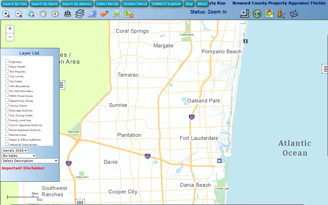
The mapped outlines help distinguish true adjoining parcels from addresses that merely sort next to each other.
Note: Map popups describe assessed parcels and owners; they do not establish who occupies each Sunrise home today.
Sunrise Street Records That Connect
No single record completes a Sunrise street directory. These address-keyed sources describe different facts, at different dates, under different custodians. The folio and legal description are the strongest links among them because they survive a mailing change, city-name change, or owner transfer.
| Address record | Official keeper | Street evidence | How to reach it |
|---|---|---|---|
| Property roll | Broward Property Appraiser | Owner, situs, mailing, folio, exemptions, sales | Free web search, GIS, Room 111 office, phone, or records request |
| Recorded instruments | Broward Records, Taxes and Treasury | Grantor, grantee, deed, lien, plat, legal description | Free index, Search and Copy, counter, phone, or request |
| Permit and code files | Sunrise Building and Code Compliance | Applicants, work, certificates, violations, case activity | EnerGov when available, staff email, microfilm viewing, or City Clerk request |
| Public voter data | Broward Supervisor of Elections | Public registered address at extract date | Lawful data request, with protected fields removed |
| Older phone books | Broward Library Periodicals | Subscriber name, residence marker, address, phone | Main Library microfiche or remote staff question |
BCPA supplies the first clean parcel identity. Official Records proves transfers and liens, while municipal files can document work at the site. Voter and phone-book evidence concerns registered voters or subscribers, not all occupants. That difference should remain explicit in every street-by-street conclusion.
The Tax Collector adds another address channel. Its lookup accepts a name, address, or account number and shows tax-bill history. Bills are issued November 1, due March 31, and become delinquent April 1. That history can confirm the account tied to a parcel, but the collector does not set assessed values or certify deed ownership. When the web result is unclear, contact the records desk at 954-357-4829, visit the county office, email inquiries@browardtax.org, or make a focused public-record request.
Follow Sunrise Addresses into Deeds
The Broward Official Records Search connects a parcel to recorded deeds, mortgages, liens, plats, notices of commencement, judgments, and other instruments. Search modes include party name, parcel ID, document type, book and page, instrument number, case number, and recorded date. A deed names grantor and grantee, but those roles describe a transfer. They do not prove that either party lived at the situs.
Full party-name searching begins at 1:47 p.m. on July 7, 1977. From 11:28 a.m. on March 9, 1972 through the prior minute, searching is limited to instrument number, book type and page, or record date. Earlier material requires RTT Search and Copy, archival books, the recording counter, phone help, or a written request. All plats and maps remain searchable regardless of date.
Exact cutoff. Do not shorten the full-search boundary to “1978.” Deed recitals and book-page references can bridge Sunrise records across the 1972 to 1977 seam.
Sunrise Permits Stay on Microfilm
Modern county parcels do not replace Sunrise's own building archive. The Building Division keeps plans, improvements, permits, certificates, structures, and building or code violations for improved lots. Most files are on microfilm. They may be viewed or copied from 10 a.m. to 3 p.m., or by appointment, and advance notice is recommended.
Call 954-572-2292 or 954-572-2353, or email BuildingRecords@sunrisefl.gov. For current code activity, Code Compliance uses EnerGov and staff channels. A complaint can add a named complainant because Florida law generally bars starting a code case from an anonymous complaint. Handle that identity with care. If the dynamic portal does not render, contact staff or make a City Clerk request rather than assuming no file exists.
Note: The microfilm counter is a documented Sunrise access channel, not evidence that every permit year or document is indexed online.
Sunrise Street Names Cross Eras
Sunrise incorporated in 1961 as Sunrise Golf Village, adopted City of Sunrise in 1971, and expanded from 1.75 square miles to more than 18 square miles through annexation. An older address may therefore appear under unincorporated Broward County, a Fort Lauderdale postal or phone-service area, a subdivision, or the earlier municipal name.
No documented citywide street renumbering surfaced in the research. The reliable continuity keys are the folio, legal description, lot and block, and plat. BCPA's City Limits and ZIP layers help explain present jurisdiction, but delivery geography is not the city boundary. This is why a Sunrise street directory should preserve the recorded parcel identity before chasing a changing place label.
- Parcel
- A mapped unit of land assessed under one folio or property ID.
- Situs address
- The physical location of the property, distinct from the owner's tax-mailing address.
- Plat
- A recorded map that fixes subdivision, lot, block, streets, and other boundaries.
- Criss-cross directory
- A directory arranged by street address rather than only by subscriber name.
Sunrise Voter Data Is Not a Roster
The individual Broward voter lookup requires personal identifiers and is designed for a voter checking their own status. It cannot browse a street. A lawful public voter extract may instead be requested from Broward Elections Records and Data and filtered by Sunrise street after delivery. The documented database search costs $20, with a $6 USB option; paper copies cost 15 cents, and special service may apply after 15 minutes.
Public data can include registration status, residence, precinct, district, and election participation, but never vote choice. Social Security and driver or state ID numbers, registration source, and copied signatures remain protected. Address Confidentiality Program participants and other protected people may have addresses suppressed. A registrant may also move or become inactive after the extract date.
Older Sunrise Streets Need Library Help
No verified Sunrise-specific reverse or criss-cross run was found. Broward Main Library Periodicals has older telephone directories on microfiche, complete local South Florida newspaper runs, and staff who retrieve microform or answer remote obituary and article questions. The Library of Congress also provides regional Fort Lauderdale telephone directories from 1947 through 1951, with linked regional volumes from 1971 through 1975.
Those books list subscribers, not the whole population. An entry may show a name, an r residence marker, street address, and old telephone exchange. Pair it with a deed or newspaper rather than calling it proof of every person in a home. The verified collections and methods belong to the Sunrise city directory research; the present street task uses them only as a dated address layer.
Limits of a Sunrise Street Directory
There is no complete public Sunrise household roll. Property records name assessed owners, deeds document legal acts, voter data covers registered people subject to exemptions, and phone books cover listed subscribers. None establishes all current occupants. Driver information is restricted by federal and Florida law, utility customer data is not an open address roll, and protected-owner records may retain a parcel description while removing the owner's name.
Absence has many ordinary causes: a renter is not on the tax roll, a voter is unregistered or protected, a subscriber chose an unlisted number, an old deed predates the web cutoff, or a city file remains on microfilm. Report only what the source shows and the date it showed it.
Lawful use. Use Sunrise address records for lawful personal research. Florida law does not permit stalking, cyberstalking, harassment, threats, or attempts to defeat protected-address programs.