
Sunrise ZIP Code Directory Areas
Six ZIPs are evidenced within Sunrise through the city's precinct map and facility addresses. They divide the original eastern development, central lake and residential areas, the Sawgrass district, the southwest business edge, and Welleby near City Hall. These examples show where each postal code is used in Sunrise. They do not define the complete USPS polygon or prove that every address carrying the code lies inside the city.
| ZIP Code | Areas Covered | Post Office | Notes |
|---|---|---|---|
| 33313 | Original east Sunrise, Waterbridge, Del Lago, Village Civic Center | Not verified | Extends beyond the city |
| 33322 | Sunrise Lakes II-IV, Lakeside Park, Nob Hill and Sunset Strip | Not verified | Central and south-central Sunrise |
| 33323 | Flamingo Park, Athletic Complex, Sawgrass Mills and arena district | Not verified | Western Sunrise |
| 33325 | Sawgrass Corporate Parkway and southwest commercial area | Not verified | Used by the Utilities office |
| 33326 | New River Circle, Civic Center, Weston Road, Sawgrass Sanctuary | Not verified | Preferred postal city varies |
| 33351 | Welleby, Piper, Westpine, and City Hall | Not verified | Principal Sunrise postal identity |
No official source in the research established a Sunrise ZIP split year, a unique institutional ZIP, a PO-box-only code, or station names. Those fields remain unclaimed rather than guessed. The safe method is to verify one full address with USPS and then check legal jurisdiction through the parcel map.
East Sunrise ZIP Geography
ZIP 33313 anchors the original east Sunrise area, including Waterbridge, Del Lago, and Village Civic Center. East Sunrise is roughly the part east of University Drive between Oakland Park Boulevard and Sunrise Boulevard. Yet 33313 continues outside municipal Sunrise. That makes it useful for finding a postal area, not for deciding which city keeps a permit or code file.
The distinction matters most for older records. Sunrise began as a planned development and incorporated in 1961 as Sunrise Golf Village. Before incorporation, an address may appear under unincorporated Broward, a Fort Lauderdale postal area, or a subdivision name. The city adopted the Sunrise name in 1971. Neither the name change nor a postal label replaces the parcel's legal description.
When a 33313 result falls near the border, compare the BCPA City Limits layer with the city's parcel context. County records remain essential even when the parcel is municipal, since the county holds the property roll, deeds, and voter data.
Central Sunrise ZIP Code Areas
ZIP 33322 covers the Sunrise Lakes II through IV area, Lakeside Park, and the Nob Hill and Sunset Strip corridor. ZIP 33351 takes in Welleby, Piper, Westpine, and City Hall. They are the most useful postal slices for much of central and north-central Sunrise, but neither code is a public roster of all occupants.
Use the codes to narrow a large dataset, then confirm each record by address and date. A public voter extract can include residence ZIP at the time of extraction, with protected people removed. Property evidence belongs to a folio and situs. A company result in the same ZIP may carry a business or registered-agent address rather than a home. Each label must retain its source meaning.
Postal slice. Treat a ZIP as a filter, then verify each Sunrise name against an address and source date.
West Sunrise ZIP Code Growth
Western Sunrise reflects decades of annexation and large-scale development. ZIP 33323 includes Flamingo Park, the Athletic Complex, Sawgrass Mills, and the arena district. ZIP 33325 is evidenced along Sawgrass Corporate Parkway and the southwest commercial zone. ZIP 33326 appears around New River Circle, Weston Road, and Sawgrass Sanctuary, where the preferred postal city can vary.
This geography grew after Sunrise expanded from its early planned footprint of about 1.75 square miles to more than 18 square miles. The 612-acre Sawgrass International Corporate Park began in 1987, Sawgrass Mills followed in 1990, and the arena arrived in 1998. Those dates help explain why western parcel, plat, and business files tend to come from later development eras than original east Sunrise.
For records research, the parcel folio, legal subdivision, and plat survive shifts in postal wording better than a last line alone. That is especially useful near Weston, Davie, Tamarac, Lauderhill, and Plantation, where delivery geography can blur the city edge.
Search Sunrise Residents by ZIP
A ZIP filter can reduce a large record set, but the available tools work differently. Broward ENVIROS accepts a ZIP field for environmental and property searches. The BCPA map displays a ZIP layer, yet no verified ZIP-wide ownership query was found in the property search itself. A lawful Broward voter-data extract may be filtered offline by ZIP, while the individual voter-status lookup is identity-gated and designed for a voter checking personal status.
- Enter the complete street address in the USPS ZIP Code Lookup. Save the delivery ZIP and preferred city exactly as returned.
- Open the BCPA Interactive Map. Find the parcel, then turn on ZIP Codes and City Limits.
- Copy the folio, situs, legal description, and jurisdiction. Keep any owner tax-mailing address separate from the physical site.
- Use Broward ENVIROS or a lawful election-data request when the record type truly accepts a ZIP filter.
- Narrow the results to a street or full address and verify the person through a dated source.
Once the ZIP is reduced to a specific road, the Sunrise street directory provides the street-level parcel and deed workflow. Do not infer a resident from a ZIP match alone.
Sunrise ZIP Fields in ENVIROS
Broward ENVIROS Advanced Property Search is a ZIP-capable portal. It deals with environmental and property records, not the BCPA ownership roll. Its address fields allow a focused search within Sunrise without pretending that ZIP alone identifies a household.
| Field | Input | Best use |
|---|---|---|
| Property Name | Name text | Find a named site or facility |
| House Number From / To | Number range | Limit an address span |
| Street Direction / Name / Type | Separate address parts | Narrow to a named road |
| City | Municipal or postal text | Add geographic context |
| ZIP | Five-digit code | Limit the postal search area |
| Property Identifier | Parcel identifier | Return to one known property |
Confirm any ENVIROS result against BCPA for the parcel and owner fields. The portals have different purposes. A shared address does not make their labels interchangeable.
Verify a Sunrise ZIP Code
The USPS address lookup is the first check for delivery geography. Enter the whole address rather than guessing from a nearby facility or neighborhood name.
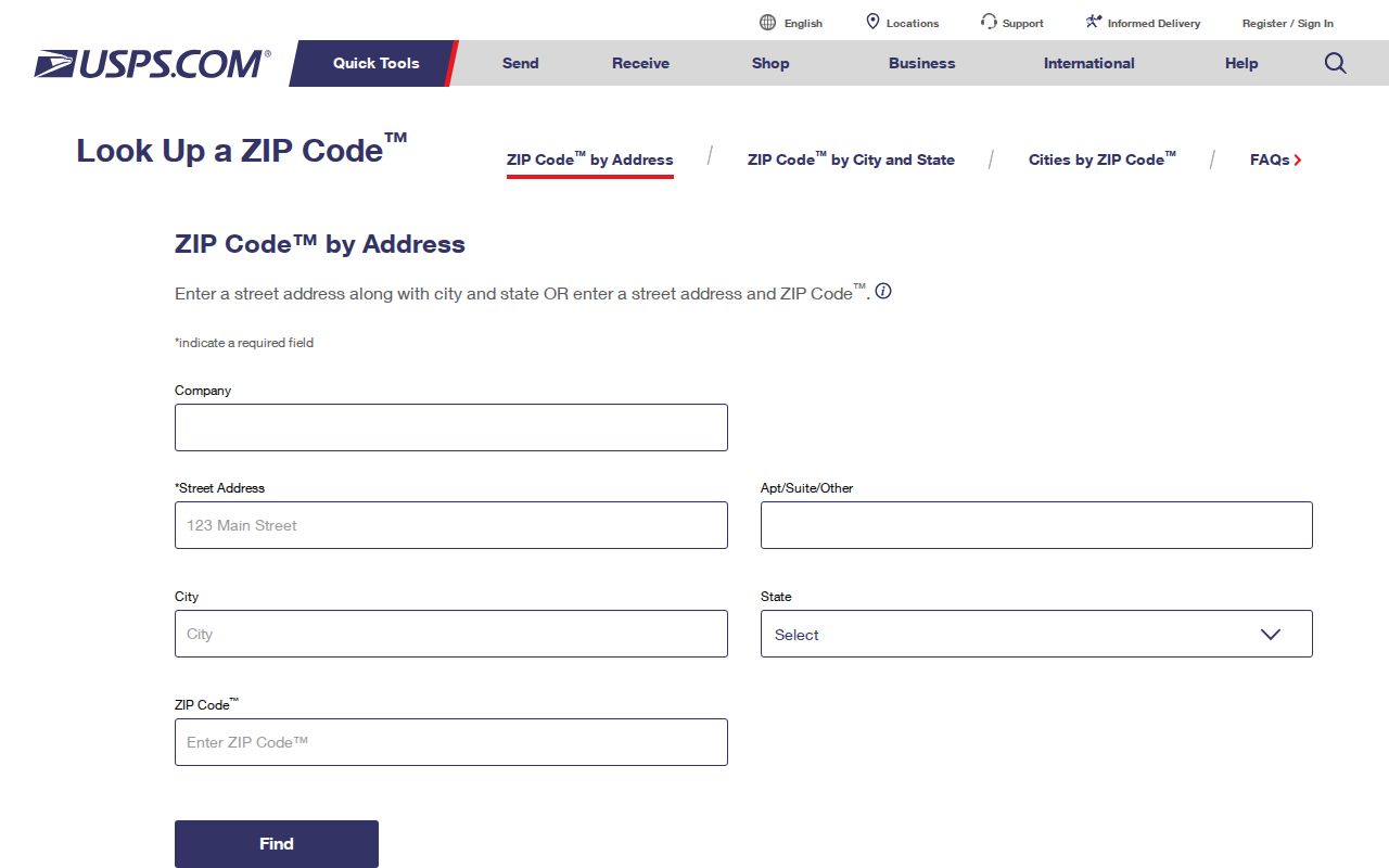
The returned last line establishes postal formatting. It does not establish municipal jurisdiction, parcel ownership, or who occupies the address.
Then compare the address with BCPA. Its parcel card identifies situs, mailing address, folio, legal description, and owner. Situs means the physical parcel location. Mailing means where tax notices go. The two may differ, and neither field should be changed into a claim about every person at the property.
Sunrise ZIPs Versus City Limits
A ZIP code organizes mail delivery. Sunrise city limits determine municipal jurisdiction. The two boundaries do not have to match. ZIP 33313 extends beyond Sunrise, and the preferred postal city varies in the 33326 area. A Sunrise last line therefore cannot by itself decide whether City Hall, another municipality, or Broward County keeps a permit or code record.
Overlay ZIP Codes and City Limits in the BCPA map, then click the parcel. Use the folio and legal description to connect county property and deed records. For local building or code files, confirm the city before selecting the custodian. Annexation is another reason older Sunrise-area records may use unincorporated Broward or a subdivision rather than the modern postal label.
The six verified postal areas also describe different parts of Sunrise. ZIP 33313 reaches the original eastern city, while 33322 covers the Sunrise Lakes and Nob Hill corridor. Western records may fall under 33323 near Sawgrass, 33325 along the southwest corporate area, or 33326 near New River and Weston Road. ZIP 33351 covers City Hall, Welleby, and the central-north area. These are useful search slices, not complete neighborhood borders. Facility addresses confirm that each code is used inside Sunrise, but they do not define every edge. No official source reviewed for this build established a Sunrise-only post-office ZIP, station name, split year, or realignment date. Keep those fields marked unverified instead of filling them from assumption.
- ZIP vs ZIP+4
- A ZIP is the five-digit delivery area; ZIP+4 adds a smaller delivery segment.
- PO-box ZIP
- A code assigned mainly or only to post-office boxes. No Sunrise example was verified.
- Unique ZIP
- A code assigned to one high-volume organization. No Sunrise example was verified.
- Carrier route
- A postal delivery path within a ZIP, not a city boundary or resident list.
Boundary check. A Sunrise ZIP code is not proof that an address lies within the incorporated city.